Public Data Querying
GeoRetina AI provides powerful capabilities for querying publicly available vector data sources. This allows you to analyze geospatial features from global datasets using natural language.
What is Public Data Querying?
Public data querying refers to the ability to search, filter, and analyze vector features (points, lines, and polygons) from publicly available datasets based on:
- Attribute values (name, type, size, etc.)
- Spatial relationships (intersection, containment, proximity)
- Combinations of attributes and spatial filters
This capability allows you to ask natural language questions about geographic entities and receive precise answers.
Common Query Types
Proximity Queries
Ask questions about features near a location:
Proximity Queries
Show me all restaurants within 500 meters of my current location
Which parks are within a 10-minute walk of this school?
List all EV charging stations within 5km of this highway exit
Attribute Queries
Filter features based on their properties:
Attribute Queries
Find all buildings taller than 100 meters in this city
Show me residential properties larger than 1 acre in this neighborhood
Identify roads with speed limits greater than 50 mph
Combining Filters
Create complex queries by combining multiple criteria:
Complex Multi-Criteria Queries
Show me hotels with at least 4-star ratings within 2km of the beach
Find public schools with enrollment over 500 students in low-income neighborhoods
Identify commercial buildings constructed before 1980 in flood-prone areas
Public Data Querying in GeoRetina AI
To perform public data queries in GeoRetina AI:
- Define your region of interest (ROI)
- Enter your query in natural language
- View the results displayed on the map
- Request additional details or refine your query as needed
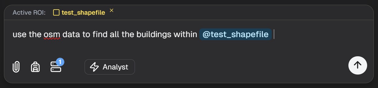
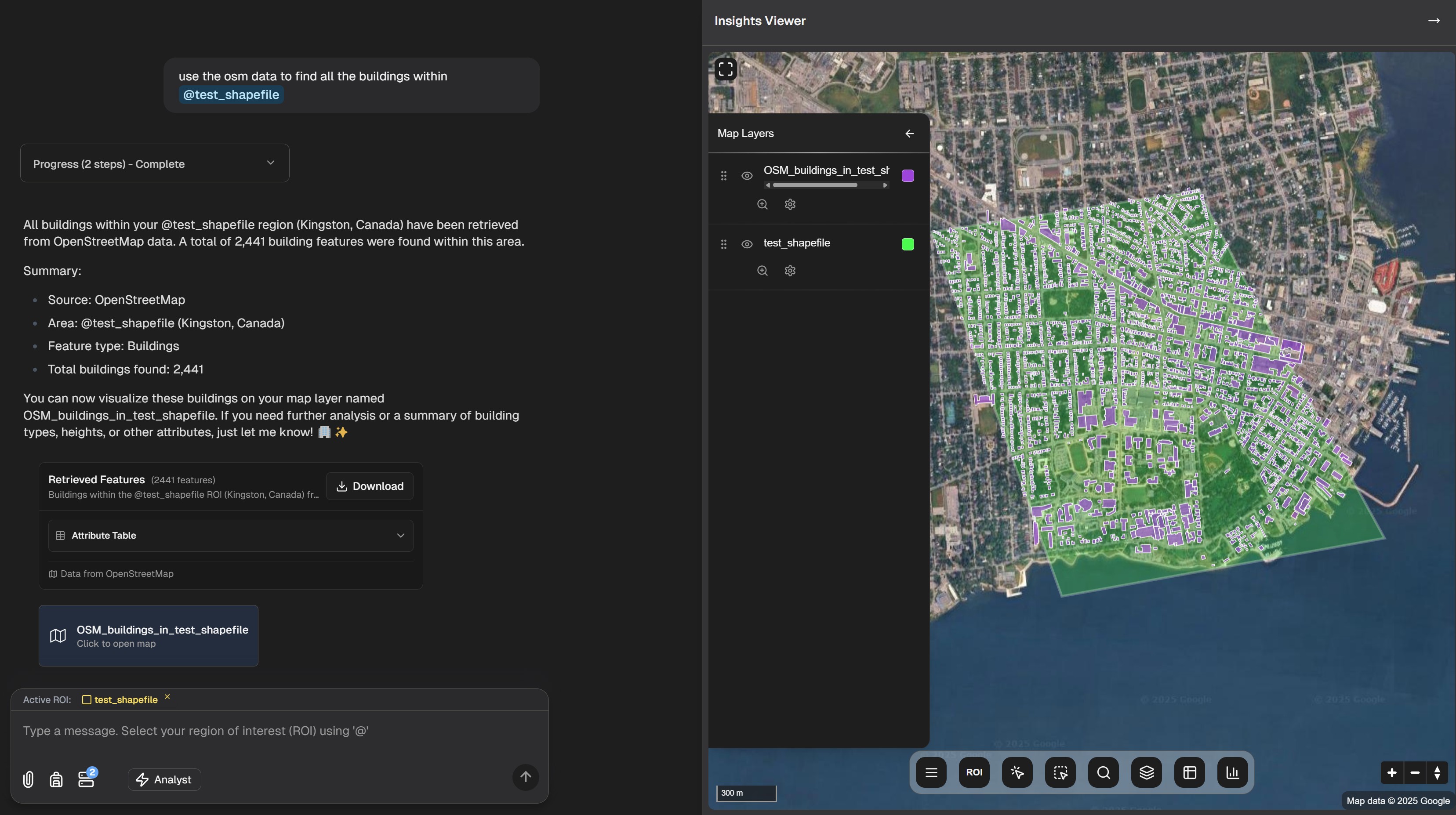
Example: OpenStreetMap Query
Here's an example of querying OpenStreetMap data:
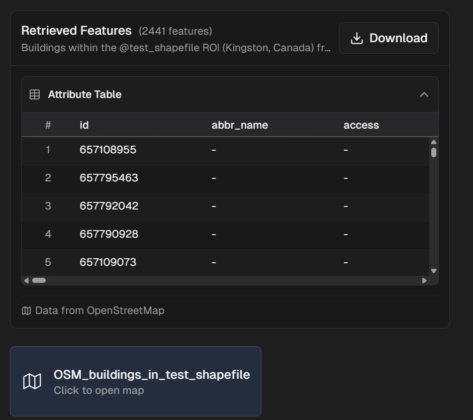
After submitting your query, the results will be displayed on the map:
You can also view the results in a tabular format for detailed analysis:
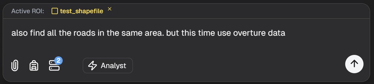
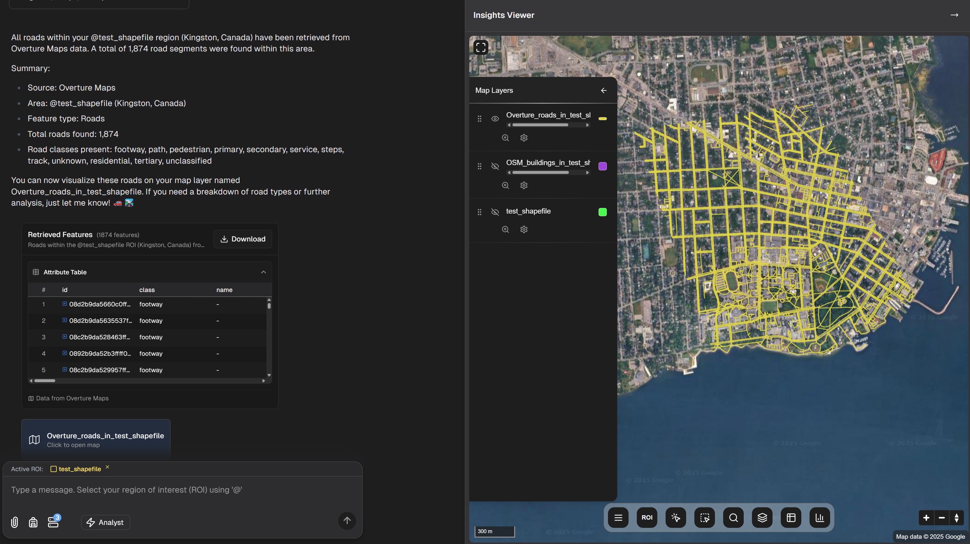
Example: Overture Maps Query
GeoRetina AI also supports querying the Overture Maps dataset:
Overture Maps results displayed on the map:
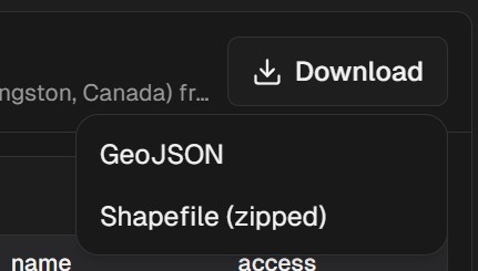
Downloading Query Results
After running your query, you can download the results for further analysis:
Supported Public Data Sources
GeoRetina AI can query features from multiple public vector data sources:
| Data Source | Features | Coverage |
|---|---|---|
| OpenStreetMap | Buildings, roads, POIs, etc. | Global |
| Overture Maps | Places, buildings, transportation | Global |
Best Practices
To get the most out of public data querying:
- Be specific in your queries: Include relevant attributes and spatial constraints
- Start with broader queries and then refine them based on initial results
- Consider data limitations: Not all areas have the same level of data coverage
- Combine with raster analysis for more comprehensive insights
- Use natural language: The AI understands complex questions and can interpret your intent
Example Applications
Public data querying is valuable for:
- Urban Planning: Analyzing infrastructure distribution and accessibility
- Real Estate: Finding properties matching specific criteria
- Transportation: Optimizing routes and service areas
- Marketing: Identifying target areas based on demographic data
- Emergency Response: Locating critical facilities and vulnerable populations
Next Steps
Continue exploring vector analysis capabilities: