Knowledge Base Integration
GeoRetina AI allows you to integrate custom knowledge bases into your geospatial analyses, enabling the AI to reference your specific documents, datasets, and domain expertise.
What is a Knowledge Base?
A knowledge base in GeoRetina AI is a collection of documents and information that the AI can access and reference when responding to your queries. This creates a more personalized and domain-specific experience by allowing the AI to:
- Reference your internal documentation
- Use proprietary datasets
- Consider industry-specific terminology and standards
- Apply domain expertise from your uploaded materials
GeoRetina AI uses Retrieval Augmented Generation (RAG) to combine domain-specific knowledge from your uploaded documents with its geospatial analysis capabilities. This allows the AI to synthesize insights from thousands of pages of your documents and apply them to geographic contexts.
Setting Up Your Knowledge Base
1. Access the Knowledge Base Page
First, click on the Knowledge Base button in the main toolbar:

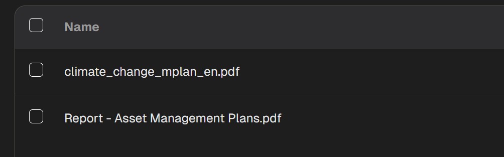
2. Add Documents to Your Knowledge Base
To add documents to your knowledge base:
- Click the "Add Document" button
- Select the PDF files you want to upload
- Add optional tags or descriptions to help organize your knowledge base

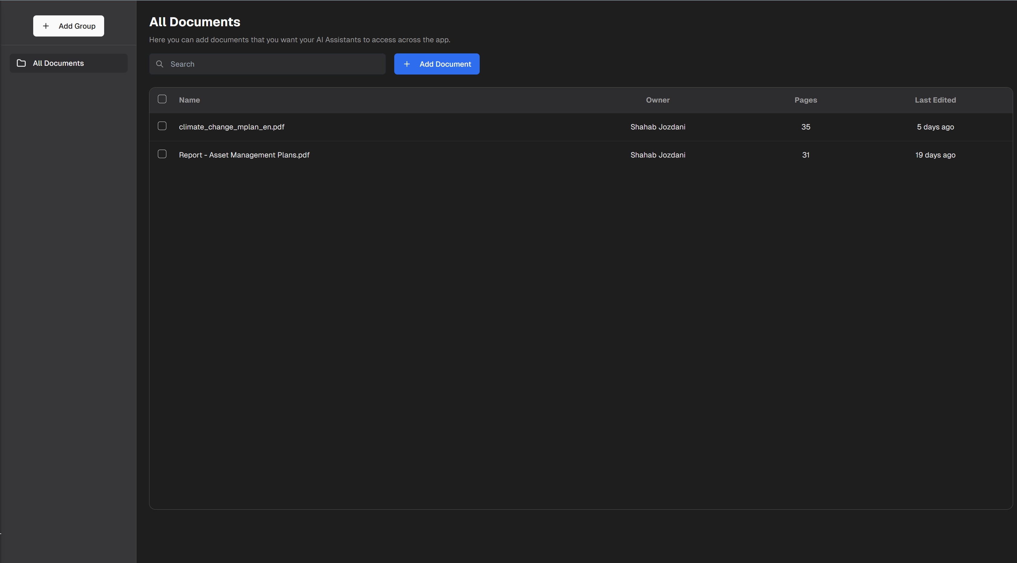
3. View and Manage Your Documents
You can view all the documents in your knowledge base, check their processing status, and organize them by tags:
4. Activate and Use Your Knowledge Base
After your documents are processed and indexed, you can activate your knowledge base for use in analyses. The AI will then be able to reference these documents when responding to your queries.
Supported Document Types
Currently, GeoRetina AI supports the following document formats:
| Format | Support Level | Notes |
|---|---|---|
| Full | Best for text-based documents with charts and figures | |
| Word (DOCX) | Partial | Good for text documents with formatting |
| CSV | Partial | Good for tabular data (beta) |
| Text (TXT) | Full | Plain text documents without formatting |
| PowerPoint (PPTX) | Coming Soon | Supports text extraction from slides |
Using Knowledge Base in Queries
Once your knowledge base is set up, you can reference it in your queries:
Using my knowledge base, analyze the urban heat island effect in Portland based on our previous studies
Referring to our policy documents, identify areas that don't comply with the zoning regulations
Based on our historical reports, show the areas with the most significant land use changes
The AI will then combine:
- General geospatial analysis capabilities
- Information from your knowledge base
- Current Earth observation data
Best Practices for Knowledge Base
For optimal results with your knowledge base:
- Use clear, well-structured documents: Well-organized content is easier for the AI to understand
- Include relevant metadata: Dates, locations, and authors help contextualize information
- Break large documents: Split very large documents into smaller, focused sections
- Include visual elements: Charts, maps, and diagrams with clear labels are beneficial
- Update regularly: Keep your knowledge base current with the latest information
- Use descriptive tags: Organize your documents with meaningful tags for better retrieval
- Test with specific queries: Verify the system retrieves the correct information
Limitations
Current knowledge base limitations to be aware of:
- Maximum of 100 documents per knowledge base (enterprise tier allows more)
- Maximum file size of 10MB per document
- Text extraction may not be perfect for complex layouts or scanned documents
- Information is private to your account and not shared with other users
- Processing time depends on document size and complexity
Example Applications
Knowledge base integration is particularly valuable for:
- Environmental consultancies: Incorporating previous assessments and reports
- Urban planning departments: Using city-specific guidelines and historical data
- Research institutions: Leveraging published studies and methodologies
- Disaster response: Incorporating critical local information during emergencies
- Agricultural management: Using crop-specific guidance and historical yields
- Policy enforcement: Applying regulations to geographic contexts
- Historical analysis: Understanding changes over time based on archival documents
For more information on customizing GeoRetina AI with your data, see the External Data Integrations guide.